Wicklow South East Map
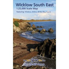
Definitive detailed map from our 25Series of South East Wicklow at 1:25,000 scale covering the coast from Wicklow town to Arklow and inland to Rathdrum & Avoca. Districts of Brittas Bay, Carrick Mountain and Avoca all shown.
Definitive detailed map from our 25Series of South East Wicklow at 1:25,000 scale covering the coast from Wicklow town to Arklow and inland to Rathdrum & Avoca. Districts of Brittas Bay, Carrick Mountain and Avoca all shown. Depicts this densely settled region in very considerable detail for the benefit of both visitor and local alike. EastWest Mapping have conducted considerable research into local sites & placenames and much information is recorded on a map here for the first time. Printed on good quality Progeo 90gsm map paper. The map sheet measures 1125mm x 820mm, covering 550 sq kilometres and is folded down to 125mm x 205mm.
Available both in standard folded paper version and folded encapsulated for durability and weatherproofing. Select your choice.
1:25,000 Scale: 1 centimetre on the map = 250 metres on the ground. Contour Interval: 5 metres.
Product Information
Product Information
Shipping & Returns
Shipping & Returns
Wicklow South East Map
Wicklow South East Map
Definitive detailed map from our 25Series of South East Wicklow at 1:25,000 scale covering the coast from Wicklow town to Arklow and inland to Rathdrum & Avoca. Districts of Brittas Bay, Carrick Mountain and Avoca all shown.
Definitive detailed map from our 25Series of South East Wicklow at 1:25,000 scale covering the coast from Wicklow town to Arklow and inland to Rathdrum & Avoca. Districts of Brittas Bay, Carrick Mountain and Avoca all shown. Depicts this densely settled region in very considerable detail for the benefit of both visitor and local alike. EastWest Mapping have conducted considerable research into local sites & placenames and much information is recorded on a map here for the first time. Printed on good quality Progeo 90gsm map paper. The map sheet measures 1125mm x 820mm, covering 550 sq kilometres and is folded down to 125mm x 205mm.
Available both in standard folded paper version and folded encapsulated for durability and weatherproofing. Select your choice.
1:25,000 Scale: 1 centimetre on the map = 250 metres on the ground. Contour Interval: 5 metres.
Original: $13.94
-65%$13.94
$4.88Product Information
Product Information
Shipping & Returns
Shipping & Returns
Description
Definitive detailed map from our 25Series of South East Wicklow at 1:25,000 scale covering the coast from Wicklow town to Arklow and inland to Rathdrum & Avoca. Districts of Brittas Bay, Carrick Mountain and Avoca all shown.
Definitive detailed map from our 25Series of South East Wicklow at 1:25,000 scale covering the coast from Wicklow town to Arklow and inland to Rathdrum & Avoca. Districts of Brittas Bay, Carrick Mountain and Avoca all shown. Depicts this densely settled region in very considerable detail for the benefit of both visitor and local alike. EastWest Mapping have conducted considerable research into local sites & placenames and much information is recorded on a map here for the first time. Printed on good quality Progeo 90gsm map paper. The map sheet measures 1125mm x 820mm, covering 550 sq kilometres and is folded down to 125mm x 205mm.
Available both in standard folded paper version and folded encapsulated for durability and weatherproofing. Select your choice.
1:25,000 Scale: 1 centimetre on the map = 250 metres on the ground. Contour Interval: 5 metres.